Manage stormwater in compliance with State permits.

Chapter 14
Watershed Resources
Introduction
Williston lies within the 8,249 square mile Lake Champlain watershed. This watershed includes portions of Vermont, Quebec, and New York. Precipitation that falls in town eventually finds its way into Lake Champlain by one of several paths as shown on Map 12 – Watershed and Source Protection.
Land development has well-documented impacts on the volume, velocity, and quality of surface runoff. Changes in these parameters have a direct impact on the stability of a stream's channel, as well as the health of the aquatic, wetland, and riparian communities associated with the stream. These impacts have propelled Williston into a major role in watershed management.
The Town of Williston protects watershed health by:
- Managing stormwater in compliance with State permits.
- Evaluating and strengthening land use regulations to limit the impact of land development on water quality.
- Working with landowners to support good stewardship of water resources through programs like No Mow May, Raise the Blade, and the BLUE Program.
- Setting a good example by practicing low-impact management of the Town's own lands.
- Developing a plan to manage stormwater in Taft Corners more efficiently so that individual lots have more space for the highest and best uses of the land.
- Engaging neighboring towns, partner organizations and volunteers in stream restoration efforts.
- Protecting floodplains and river corridors by avoiding development within them and acquiring conservation easements.
- Enhancing public access to water resources for recreation and education, to encourage a sense of connection and investment in those resources.
- Supporting the efforts of Lake Iroquois Association and other watershed groups.
- Working with the Vermont Department of Environmental Conservation, Champlain Water District and private water suppliers to protect water quality.
Goals: In 2050, Williston is...
»»
Livable
... because protecting Williston's surface waters and riparian zones safeguards wildlife corridors and habitats. Protecting good access to the Town's water resources enhance their recreational value by offering spaces for people to unwind and connect with nature, thus enhancing their quality of life. Williston's water quality protection efforts maintain clean water in all town lakes, ponds, waterways, and thereby contribute to clean water downstream and in nearby Lake Champlain.
»»
Resilient
...because by protecting its water resources, Williston is resilient to climate-related challenges like droughts or floods. By maintaining healthy ecosystems including wetlands and upland forests and by ensuring sustainable water management, Williston reduces the risks of water scarcity or flood damage during extreme weather events. Undisturbed wetlands and floodplains attenuate flooding, protecting downstream homes and infrastructure.
»»
Equitable
...because when water resources are protected and managed responsibly, it ensures that everyone in the town, regardless of income or background, has access to the same quality of water. By focusing on the protection of water resources, Williston fosters a healthier, more equitable environment, where all residents thrive, and where the community can better withstand environmental challenges.
Three Things to Know
1
WILLISTON HAS A RESPONSIBILITY TO MANAGE WATER RESOURCES AS PART OF THE LAKE CHAMPLAIN WATERSHED
The majority of Williston's land area is part of the Winooski Sub-basin, which is the largest of 11 major sub-basins in the Lake Champlain watershed. The Lake is a crucial component of Vermont's ecology, culture, and economy, and must be responsibly stewarded for future generations.
2
WILLISTON MANAGES WATERSHED HEALTH PRIMARILY THROUGH ITS STORMWATER PROGRAM
In 2015, the Town's Department of Public Works formally established a Stormwater Program to meet state and federal regulatory requirements, manage drainage upkeep, and support local initiatives.
3
WILLISTON MANAGES STORMWATER TO COMPLY WITH STATE PERMITS
Major changes in the stormwater program are often driven by decisions made on a state-wide level. The town currently has limited resources to support activities outside of permit compliance.
Three Things Public Engagement Told Us
1
WATERSHED AND SOURCE PROTECTION IS DESIRABLE AS PART OF THE TOWN'S RESPONSE TO CLIMATE CHANGE
20% of people thought that stormwater, green space, and climate resilience were the biggest energy and climate challenges facing Williston.
2
THE PEOPLE OF WILLISTON VALUE ACCESS TO THE TOWN'S WATER RESOURCES
Community engagement efforts found that the vast majority of participants value access to protected open space and undeveloped areas, including wetlands, waterways, and wildlife habitat.
3
RESIDENTS REQUEST EXPANDED INFRASTRUCTURE TO MANAGE STORMWATER
When asked, "What changes or improvements are overdue for Williston?" multiple respondents suggested larger culverts to mitigate the effects of stronger storms and an expansion of wastewater infrastructure to allow for housing growth.
Williston's Watersheds
Williston lies within the 8,249 square mile Lake Champlain watershed. This watershed includes portions of Vermont, Quebec, and New York. Runoff from the town eventually finds its way into Lake Champlain by one of several paths as shown on Map 12 – Watershed and Source Protection. Williston's watersheds are summarized below:
- The Muddy Brook runs along Williston's western border forming the boundary to South Burlington. It's 20.8 square mile watershed includes the Sucker Brook tributary and occupies approximately 9.8 square miles in Williston. The Muddy Brook watershed includes the retail centers in Taft Corners and Maple Tree Place and a portion of the industrial and commercial facilities in the north-west corner of the town. The Muddy Brook fails State water quality standards for toxins, nutrients, and temperature for the last seven miles of the tributary due to urbanization of this watershed.1
- The Allen Brook originates above Mud Pond and flows northwest to join the Muddy Brook just before the confluence with the Winooski River. The Allen Brook watershed falls entirely within the town and is Williston's largest watershed, encompassing roughly 10.8 square miles. The Allen Brook watershed includes agricultural and forested lands, residential development, and a portion of the industrial and commercial facilities near the confluence with Muddy Brook. In the early 2000's this tributary failed State water quality standards for stormwater and E. coli from the headwaters down to Industrial Avenue. Water quality in Allen Brook is not currently being measured so it is unknown if the waterway is still impaired.
- Several small tributaries flow directly into the Winooski River, draining approximately 8.4 square miles in total.
- Lake Iroquois and the surrounding lands are part of the LaPlatte River watershed, ultimately draining into Shelburne Bay. Lake Iroquois drains into Patrick Brook, which joins the LaPlatte River in Hinesburg. This watershed includes about 1.7 square miles in Williston.
- Finally, less than one hundred acres each of the Johnnie Brook and Shelburne Pond watersheds are within the town.
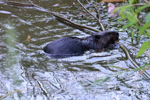
Williston's rivers, brooks, streams, wetlands, and ponds provide habitat for aquatic species that live in town. Their vegetated margins, or 'riparian zones,' extend this habitat and act as travel corridors and migration pathways for animals and plants between disconnected forest blocks. By protecting Williston's surface waters, we are protecting wildlife, their habitat, and the areas they use to move through town.2
Evan P. Fitzgerald, Samuel P. Parker, 2009. Muddy Brook Phase 1 and 2 Stream Geomorphic Assessment Summary. http://www.town.williston.vt.us/vertical/sites/%7BF506B13C-605B-4878-8062-87E5927E49F0%7D/uploads/%7B922450B7-536D-4114-A65A-AE44AF7AE55D%7D.PDF. Accessed December 5, 2024.
Dylan O’Leary, 2022. Williston Wildlife Corridors. https://storymaps.arcgis.com/stories/e373041378f849a496042ba134426a14. Accessed December 4, 2024.
Stormwater Management
The Town of Williston discharges stormwater under the authority of a Small Municipal Separate Storm Sewer System (MS4) General Permit issued by the State of Vermont Agency of Natural Resources. As a condition of the permit, the Town is required to develop a Stormwater Management Plan3, last updated in 2024, which addresses how the Town will prevent stormwater runoff from
Town of Williston Stormwater Management Program. Accessed 4/15/2025 at https://www.town.williston.vt.us/vertical/Sites/%7BF506B13C-605B-4878-8062-87E5927E49F0%7D/uploads/FOR_SUBMITTAL_Williston_SWMP_Update_2024_V2.pdf
carrying potential pollutants to receiving surface waters. Potential pollution sources may include runoff from agricultural fields, erosion run-off, residential areas where excessive lawn treatment chemicals or fertilizers are applied, parking lots where vehicles may have leaked fluids and where salts are often applied during winter months, or construction sites where large areas of disturbances are common. Each of these potential pollutant sources needs to be identified and mitigated to minimize their potential for commingling with stormwater runoff and eventually entering our waterways.
When receiving waters do not meet their intended use due to a specific pollutant(s), additional standards for the Stormwater Discharges to that water body become required. In the Town of Williston, our stormwater is received by seven surface water bodies which include the Allen Brook, Johnnie Brook, Lake Iroquois, Muddy Brook, Shelburne Pond, Sucker Brook, and the Winooski River. Of these seven waterbodies Allen Brook, Muddy Brook, and Lake Iroquois are listed as impaired by the State of Vermont, but only the Allen Brook has discharge restrictions at this time. Muddy Brook and Lake Iroquois are being monitored as local cleanup efforts continue. Under the MS4 permit the Town of Williston is required to implement a Stormwater Flow Restoration Plan4 to address the impacts stormwater discharges are having on the Allen Brook. The required plan was developed and approved by the State in 2016. The ultimate goal of an FRP is to identify stormwater treatment practices (including retrofits to existing systems) which when implemented will work towards removing an impaired waterbody from the States List of Impaired Waters.
Williston launched a Stormwater Program operating in the Department of Public Works with a Stormwater Coordinator in 2015. The fee-based Program was formed to facilitate the ongoing maintenance and upkeep of the town-wide stormwater drainage network, address increasingly stringent state and federal permitting requirements and support local water quality initiatives. Prior to the establishment of that program, the Williston Conservation Commission and Conservation Planner were charged with monitoring water quality and improving watershed health through such actions as stream cleanups, riparian plantings, stormwater management and public engagement and education.
The Williston stormwater program and services are designed to comply with the State's "MS4" permit. Therefore, major changes in the stormwater program are based on State regulatory requirements, especially as the Town currently has limited resources to expand the program beyond permit compliance. While the Town cannot predict how the MS4 permit or state regulations will change over the next eight years, we do know that maintenance costs will increase for the Stormwater Program and for private landowners as our newer facilities will need to be cleaned. Frequent, severe storms due to climate change will put greater pressure on our older infrastructure, and the Town should make efforts to repair and protect riparian zones, upgrade infrastructure, and control the increase of impermeable surfaces.
The Town should evaluate its land use regulations, specifically Chapter 29 – Watershed Health, to make sure that they effectively minimize the impact of land development on water quality, and amend the regulations as needed.
Dubois & King, Inc. Town of Williston Allen Brook Flow Restoration Plan. Accessed 4/15/2025 at https://www.town.williston.vt.us/vertical/Sites/%7BF506B13C-605B-4878-8062-87E5927E49F0%7D/uploads/Allen_Brook_Flow_Restoration_Plan.pdf
Stormwater Management in Taft Corners
The Taft Corners Vision Plan noted stormwater management as an overarching issue that will affect how the area is developed. The Vision Plan stated, "The current practice of pushing storm-water management entirely onto individual lot owners is a guarantee of a smaller tax base and a bigger environmental footprint. It ultimately forces an automobile-dependent environment." Rather, stormwater management should be handled collectively like water or sewer, either as a Town utility or via a shared responsibility among landowners.5
Approaching stormwater management in this way will be more efficient and effective and will help ensure that the available land is used for its best and highest use. There may be additional opportunities for public green space around larger stormwater facilities.
Town of Williston, 2021. Taft Corners, Williston, Vermont: Vision Plan Created by the Residents of Williston. Accessed on 4/15/2025 at https://www.town.williston.vt.us/vertical/sites/%7BF506B13C-605B-4878-8062-87E5927E49F0%7D/uploads/Taft_Corners_Vision_Plan.pdf.
Stewardship
While State and Federal government entities are ultimately responsible for protecting our local waterways, the Town of Williston will strive to keep those waterways free and clear of contamination. Quality of life is linked to a healthy environment. In recognizing this mainstay, the town will strive to become a sustainable community of citizens and businesses motivated to conserve and enhance natural resources through policies, programs, and outreach activities.
The Town can support stewardship of our waterways by taking the lead and practicing good stewardship of its own lands. Such practices include minimizing mowing where feasible and, where mowing must occur, raising the level of the mower blades to 3 inches; restoring wetlands where feasible, and replacing mowed grass with native vegetation that slows runoff and promotes infiltration.
The Town can also encourage good stewardship through promotion of programs like No Mow May6, Raise the Blade7 and the BLUE Program to address stormwater issues in residential areas. BLUE evaluators educate and collaborate with residents to identify opportunities for stormwater mitigation such as rain gardens, rain barrels, permeable driveways, infiltration trenches, gutter re-directs, dry wells, etc. to reduce pollutants and phosphorus overload to Williston's waterways.8
Plantlife. No Mow May. Accessed 4/15/2025 at https://www.plantlife.org.uk/campaigns/nomowmay/.
Lawn to Lake. Raise the Blade program. Accessed 4/15/2025 at https://lawntolake.wpengine.com/?page_id=13.
BLUE Williston. Sea Grant Lake Champlain. Accessed on 3/24/2025 at https://www.uvm.edu/seagrant/blue/blue-williston
Stream Restoration
Efforts to restore Williston's named streams began in 2001 with the Sucker Brook stream stabilization project. In the mid-1980s, a high flow event re-routed Sucker Brook out of its channel, away from a 25-ft waterfall, through an abandoned sand and gravel pit traversing exposed sand, silts, and clays. Over the next twenty years, the channel steadily eroded. Approximately 72,000 cubic yards of material were transported downstream, leaving a steep, unstable channel at the bottom of a 40-ft gully.9 From 2001 – 2008 the Town worked with VT DEC and other partners to successfully stabilize the Sucker Brook. Monitoring of the restoration site is ongoing.
From 2004 - 2012 a substantial restoration project was completed on the Allen Brook. A comprehensive decision matrix was developed to assess 158 parcels along the Allen Brook and its tributaries to identify properties where restoration efforts were expected to have the greatest impact.
Dubois & King, Inc. website. Sucker Brook Channel Stabilization and Natural Channel Design. Williston, Vermont. Accessed 4/15/2025 at https://www.dubois-king.com/projects/sucker-brook-channel-stabilization-and-natural-channel-design/.
Acquisitions or conservation easements on high priority parcels permanently protected 37 acres of land along the Allen Brook and its tributaries, and 18 acres within stream buffers were planted with native trees and shrubs. Steep and highly erodible stream banks were strategically cut back and gradually sloped in many locations, resulting in the removal of 228 cubic yards of sediment.10
The Actions and Strategies in this chapter call for evaluating the effectiveness of the Allen Brook restoration project, coordinating with the city of South Burlington on planning restoration projects along the Muddy River, and evaluating other riparian corridors in Williston for restoration potential.
Stream Buffer Restoration. Town of Williston website. Accessed 4/15/2025 at https://www.town.williston.vt.us/index.asp?Type=B_BASIC&SEC={5E27EA55-FB4C-4420-9162-64DC7BF93780}.
Flood Resilience
The Town of Williston has developed strategies to build flood resilience. This includes identifying areas vulnerable to flooding or fluvial erosion; designating those areas to be protected to mitigate risks to public safety, critical infrastructure, historic structures, and municipal investments; locating new development in safer areas; using sound stormwater management techniques to reduce flooding; conserving floodplains and upland forested areas that attenuate flooding; and encouraging flood emergency preparedness and response planning (see Chapter 12 – Hazard Mitigation). The town will continue to implement these strategies.
Williston's regulations include "watershed protection buffers" for all streams, ponds, lakes and for certain wetlands. These include:
- A shoreline buffer of at least 150 feet for all ponds and lakes exceeding an area of a half-acre;
- A shoreline buffer of 250 feet for Lake Iroquois;
- A buffer of at least 150 feet for the Allen Brook, Muddy Brook, Sucker Brook and Winooski River;
- A 50-foot buffer for all unnamed streams;
- A 50-foot buffer around all Class 2 Wetlands and certain Class 3 Wetlands, and
- Special Flood Hazard Areas
The town's regulations stipulate that land within these buffers shall remain undeveloped and in native vegetation. In total, the watershed protection areas generally provide greater protection than the statewide River Corridors under the jurisdiction of Vermont Agency of Natural Resources, and very little land area is within the River Corridors that are not already under the town's watershed protection buffers (see Map 12 – Watershed and Source Protection). Nonetheless, to assure consistency with State statute and with surrounding towns, the town should consider incorporating the ANR River Corridors into the flood hazard protection standards in the Bylaw. Similar to the Special Flood Hazard Areas, the River Corridors should become part of the watershed protection buffers listed above.
Stormwater management techniques can also help to slow the spread of floodwater. It should be noted that stormwater treatment standards required under Vermont law are designed to capture 90% of the annual storm events and to safely "pass" a 100-year storm event, meaning that even well-designed stormwater infrastructure won't prevent flooding in an extreme event.
Lake Iroquois
Lake Iroquois is a 229-acre kettle pond that lies in the Lake Champlain watershed and is bounded by the towns of Williston, Richmond, St. George and Hinesburg. The lake was formed after the last ice coverage in Vermont receded about 15,000 years ago. Over the years, the lake has naturally become more eutrophic, and it has been the site of significant human development and use in the last 150 years. By 1900, settlers had cleared most of the Lake's watershed for farming and began to build seasonal camps on its shores. A hundred years later, much of the watershed is reforested but most of the shoreline has been developed with over 90 summer camps and year-round homes.
A dam built on the lake's outlet in the mid-1800s was used to control the water supply to mills downstream in Hinesburg. Milling declined in the 20th century and in the 1960s the dam was intentionally cemented in its top position, keeping the pond at its current level throughout the year. Approximately 32 streams flow into the lake on the north, east and west sides, the largest flowing in from the northwest (crossing Beebe Lane). There are also several streams that bubble up from the lake bottom.
The lake is used extensively throughout the year by residents and by visitors. The Lake Iroquois Recreation District (LIRD) maintains the public beach at the north end of the lake. The LIRD also maintains a trail network on the land around the lake. The trails are accessible from the beach parking lot. The Vermont Fish & Wildlife Department maintains the fishing access and boat ramp, also at the north end of the lake, which provides public access to the lake for boating and fishing.¹¹
The Vermont Agency of Natural Resources has classified Lake Iroquois as eutrophic, meaning that the Lake's waters are rich in nutrients (i.e. phosphorous, nitrogen) that promote the proliferation of plant life, especially algae, which in turn reduces the dissolved oxygen content that fish and other aquatic species rely on for survival. The elevated nutrient levels in the Lake have also contributed to the spread of the invasive aquatic plant, Eurasian Watermilfoil (Myriophyllum spicatum). Since 1979, studies have indicated that Lake Iroquois has one of the highest average levels of phosphorus of all lakes in the State.¹²
The Lake Iroquois Association (LIA) is a 501(c)(3) non-profit corporation whose sole purpose is to maintain and enhance the Lake Iroquois ecosystem. The LIA aims to encourage and guide appropriate public uses of the lake and its watershed for the purpose of protecting and preserving the lake's overall well-being. These goals are achieved through monitoring, preventive and management initiatives, research, education, advocacy and other actions, involving the cooperative efforts of property owners, Town, State and Federal officials, and other interested parties.¹³
The LIA's efforts are paying off. In 2022 the Vermont DEC granted the Lake Iroquois Association the "Gold Lake Wise Award"¹⁴ to recognize that 15% of the properties surrounding the lake follow shoreland best management practices and have received an individual Lake Wise Award¹⁵ for their efforts. The town should support the efforts of the LIA through direct funding and in-kind contributions, to help them achieve their mission to restore the lake.
Source Water Protection
Williston residents and businesses receive their drinking water from one of three sources: a private well, which is managed by the landowner; the Lake Iroquois Source Protection Area, which is supplied by the Champlain Water District (CWD); or the Porterwood Source Protection Area, which is supplied by the Williston Fire District #1 (FD1). Williston's two Source Protection Areas (SPAs) are shown on Map 12. Water suppliers who manage SPAs are responsible for developing and updating Source Protection Plans (SPPs), which are designed to maintain the integrity of the SPA. These Plans must comply with State and Federal Rules governing water supply protection. This chapter calls for Williston to ensure that all development activities within the designated SPAs are consistent with the SPPs; therefore, development proposals within SPAs will be referred to their water suppliers for comment prior to the issuance of a permit.
Groundwater Protection
Groundwater in Williston is protected under the jurisdiction of the Vermont Department of Environmental Conservation Drinking Water and Groundwater Protection Division. The Regional Office Program issues water/wastewater permits (WW Permits) for soil-based wastewater systems with flows of less than 6500 gallons per day, for potable water supplies (water supplies that are not public water supplies), and for municipal water and sewer connections. The Vermont Wastewater System and Potable Water Supply Rules (adopted June 30, 2007) supersede existing municipal ordinances and zoning bylaws that regulate potable water supplies and wastewater systems. Municipalities may continue to have ordinances and/or bylaws that: (1) only regulate the use and/or operation of municipally owned water and/or sewage treatment plants; (2) require submission of copies of plans and documents used to obtain a state permit under these Rules to the municipality; (3) require a certificate of occupancy that is based on full compliance with a state permit issued under these Rules; (4) require notice of, and have the option to observe, any soil testing such as the digging of test pits; and (5) require time of sale inspections. In light of its limited authority to regulate water supplies and wastewater systems, Williston will work with the Vermont Department of Environmental Conservation to further the goals of protecting groundwater quality and quantity.
Objectives, Strategies and Actions
Objectives
14.A
14.B
Improve Williston's watershed health by investing in the stormwater program, working with landowners, protecting and enhancing ecological resources that benefit water quality, and coordinating with other organizations, neighboring towns, and the state.
14.C
Improve Williston's flood resilience by directing development away from vulnerable areas and by permanently protecting high priority areas within riparian corridors.
14.D
Manage stormwater in Taft Corners communally rather than on a parcel-by-parcel basis, to reduce the environmental footprint of those systems and allow more land to be used for its highest and best use optimal value.
14.E
Improve and enhance public access to water resources in town, providing opportunities for recreation and education, which demonstrates the value of water resources and helps connect people with the process to protect those resources.
14.F
The town will participate in partnerships to improve the Lake Iroquois ecosystem.
14.G
The Town of Williston will work with the Vermont Department of Environmental Conservation Drinking Water and Groundwater Protection Division to help protect both groundwater quality and quantity.
Strategies
14.1
The Town of Williston will continue to operate as a Municipal Small Separate Stormwater System (MS4) within the framework established by the Clean Water Act, under the General Permit for MS4s issued by the State of Vermont and the State's stormwater legislation.
14.1.1
Maintain implementation of the Stormwater Management Plan and update as needed.
14.1.2
Support regional efforts to implement required public education, outreach and participation.
14.1.3
Develop strengthened regulations that limit the impact of land development on water quality. Continue to monitor and evaluate the effectiveness of these standards and consider referencing new technologies and stormwater management strategies as they are developed.
14.1.4
Evaluate, in partnership with The Vermont Department of Environmental Conservation (DEC) Watershed Management Division staff, the standards of WDB 29 Watershed Health, to ensure that the regulations reflect current best practices and technologies.
14.1.5
Evaluate how best to implement the Allen Brook Flow Restoration Plan, with the ultimate goal to utilize stormwater treatment practices (including retrofits to existing systems) that will help improve the water quality of Allen Brook to the point where it is no longer listed as impaired.
14.1.6
Develop and implement stormwater improvements using Stormwater Program funding. Continue to charge fees based on the amount of a property's impervious surfaces.
14.1.7
Evaluate stormwater issues in older developments. Continue to monitor and maintain Town-owned and Town-managed stormwater treatment practices.
14.1.8
Implement the Stormwater Program utilizing the DEC Clean Water Program and Funding.
14.2
The Town should strive to practice low-impact management on its properties by reducing the use of pesticides and fertilizers, by reducing the extent of mowed, heavily managed landscapes, and by reducing the frequency and impact of mowing on those landscapes.
14.2.1
Develop an operations policy to minimize mowing of wetlands, buffers, and meadows to prioritize habitat and ecosystem function on town land such as the Town Hall meadow, Allen Brook Field along the recreation path, between the recreation path and Lambert Lane, and the disc golf course. Delineate wetlands to inform decision making, and plan to restore wetlands where practicable.
14.2.2
Develop a plan to reduce the amount of mowed grass on town land and replace it with native and edible plantings to slow runoff, promote infiltration, provide habitat, and edible foods.
14.3
Encourage and support low-impact development.
14.3.1
Support No Mow May, Raise the Blade and other piloting programs that incentivize landowners to 're-wild' their lawns.
14.3.2
Support and encourage landowners to plant landscaping that is appropriate for their specific microclimate, for example drought-resistant plants for dry, sandy soils or specific plants for wet clay soils.
14.3.3
Support volunteer programs such as the BLUE Program to address stormwater in residential areas. BLUE evaluators educate and collaborate with residents to identify opportunities for stormwater mitigation, such as rain gardens, rain barrels, permeable driveways, infiltration trenches, gutter re-directs, dry wells, etc. to reduce pollutants and phosphorus overload into Williston's waterways.
14.4
Reevaluate the manner in which stormwater is managed in the Taft Corners Form Based Code district. The current practice of lot-by-lot stormwater management increases the environmental footprint and forces auto-dependency. Stormwater needs to be handled communally (like water or sewer) via shared responsibility among owners.
14.4.1
Evaluate, via a scoping study, to determine the best location for collective stormwater treatment and any potential barriers.
14.4.2
Evaluate available funding sources to design and implement a collective stormwater system.
14.5
The Town will support water quality and stream restoration efforts through the engagement with partners such as the Winooski NRCD, Friends of the Winooski River, and volunteers.
14.5.1
Support and coordinate with the City of South Burlington on the planning and funding of targeted restoration projects along the Muddy Brook.
14.5.2
Evaluate the effectiveness of the previous 2008-2011 Allen Brook Restoration project on stabilizing stream banks and improving water quality.
14.5.3
Evaluate other riparian corridors in Williston and then develop a plan to reforest areas with the help of partner organizations and volunteers.
14.6
Avoid development and protect land in particularly vulnerable areas such as floodplains and river corridors. Permanently protect land within river corridors and floodplains to enhance flood storage capacity and allow streams room to move, so that over time streams will become more stable.
14.6.1
Evaluate the incorporation of river corridors into WDB Chapter 28, in order to assure consistency with State statute and with surrounding towns, and to ensure that the town retains the maximum level of Emergency Relief Assistance Funding. Williston Development Bylaws Chapter 28 regulates development in Special Flood Hazard Areas (SFHA). All new development, with minor exceptions, is prohibited in the SFHA.
14.6.2
Prioritize parcels to target for acquiring river corridor easements and restoring floodplain.
14.6.3
Evaluate how to conduct outreach to landowners to discuss opportunities for conservation and/or flood zone protection projects.
14.6.4
Fund acquisitions with Environmental Reserve Fund and grant funding.
14.7
Maintain, protect, and where possible, enhance access to water resources for recreation and educational opportunities. Some access to water resources is, appropriately, informal; however, the town should evaluate locations where access can be improved and formalized.
14.7.1
Evaluate and identify locations for improved public access to water resources in collaboration with partners such as Northern Forest Canoe Trail and Vermont River Conservancy.
14.7.2
Evaluate the cost and feasibility of improving access at select locations.
14.7.3
Implement public access improvement projects with a mixture of grants and town funding.
14.8
Support the efforts of the Lake Iroquois Association and other organizations to improve the water quality of Lake Iroquois.
14.8.1
Maintain support of the LIA, through direct funding and in-kind contributions, to help them achieve their mission to restore the lake.
14.9
In light of the town's limited authority to regulate water supplies and wastewater systems, Williston will work with the Vermont Department of Environmental Conservation to further the goals of protecting groundwater quality and quantity.
14.9.2
Support ending the duplicative permitting for development served by municipal water and sewer. To ensure that a wastewater system has been installed as designed, as-built plans must be filed with the Zoning Administrator prior to issuance of a certificate of compliance.
14.9.3
Evaluate the need to require hydrogeologic studies or whether the town should defer that responsibility to the State since the State is responsible for issuing Water and Wastewater Permits.
14.10
Maintain the practice of notifying the Champlain Water District of development proposals within the Lake Iroquois Source Protection Area.