By 2050, Williston has permanently protected 30% of its land area through conservation easements and acquisitions.
Chapter 13
Land-based Conservation Resources
Introduction
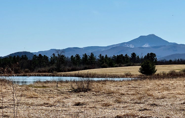
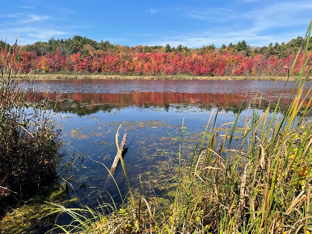
Positioned between the lowlands of the Champlain Valley and the foothills of the Green Mountains, the town of Williston has a unique physical setting whose roots trace back over millennia to ancient river deltas in Glacial Lake Vermont and to the great tectonic forces of geology that uplifted the Green Mountains and shaped the very bedrock the town stands on. Those same geological forces create the patterns we see on the landscape today. From moist floodplain forests and wetlands to dry craggy ridgelines, Williston hosts diverse plant communities and is home to abundant wildlife including bobcats, fishers, black bears and moose as well as a rich springtime chorus of amphibians and birds.
In recent times, Williston's landscape has experienced rapid, dramatic change. Residential, commercial and industrial development has not only resulted in forest fragmentation and loss of forest cover; Williston has also lost a sizeable area of productive farmland to development.
Fortunately, as it has grown from a small rural town to Vermont's 11th largest town by population1, Williston has proactively taken steps to protect its rural landscape.
Although the center of Williston is planned as dense and mixed-use, most of the town remains rural with working landscapes, vibrant forests, and unique natural communities. While Williston is a commercial center for the region, much of its natural lands remain due to a long history of land conservation and protective land use policy.
As community values and identity have shifted over time, Williston's conservation goals have evolved. Today, Williston aims to conserve land for climate resilience, ecological value, agricultural and silvicultural working lands, scenic aesthetics, and recreation. Often, conserving a single parcel of land can result in multiple co-benefits. For example, Mud Pond Conservation Area is valued for its wetlands and unique ecosystems which support a diversity of plant and wildlife species. It is also home to approximately 1.4 miles of walking trails and a section of the Vermont Association of Snow Travelers (VAST) snowmobile trail system.
This chapter outlines long-range strategies for preserving and protecting Williston's forests, scenic viewsheds, working landscapes, and recreational/cultural/natural resources.
United States Census Bureau, City and Town Population Totals 2020 to 2023. https://www.census.gov/data/tables/time-series/demo/popest/2020s-total-cities-and-towns.html. Accessed October 9, 2024.
Goals: In 2050, Williston is...
»»
Livable
... because over 30% of the land area is protected as open space and the public has equitably distributed access to open space for non-motorized recreation such as walking, biking, skiing and snowshoeing. Local farms have diversified their operations in a sustainable way and some include managed public access. Protecting natural features like wetlands, stream buffers, forest blocks, and habitat connectors provides habitat for wildlife, improves water quality, filters stormwater runoff and reduces downstream flooding. Natural areas are deeply important to people who live in and visit Williston and contribute to their mental and physical well-being. Supporting accessible public conservation resources for recreation, outdoor education, and scientific research makes Williston livable.
»»
Resilient
...because forests and wetlands sequester carbon and help mitigate climate change. Additionally, green spaces and vegetation within urban areas provide cooling effects, reducing the urban heat island effect and making the town more comfortable during extreme weather events. A diverse range of plants and animals is essential for ecosystem health and resilience. Preserving biodiversity ensures that ecosystems can adapt to changes and continue to provide vital services. Supporting local farms and community-based agriculture ensures a stable local food supply and can insulate the town from supply chain disruptions.
»»
Equitable
...because the town's trails and parks are free to use and accessible to all. Ample recreation path connections to trails and parks ensure equitable access for all members of Williston's community. The town has preserved scenic views and established natural areas close to Taft Corners, where most of the town's population lives. The green spaces within the growth center provide opportunities for quiet respite or recreation for people who live and work there.
Three Things to Know
1
WILLISTON HAS CONSERVED 16% OF ITS LAND AREA
As of 2024, Williston has permanently conserved 3,049 acres of land through easements and Town ownership – that's 16 percent of the town's land area! Positioned between the lowlands around Lake Champlain and the foothills of the Green Mountains, Williston is home to 10,103 people making it the 11th largest town by population in the state², yet most of the town remains rural with working landscapes, vibrant forests, and unique natural communities. While Williston is also a commercial center for the region, much of its natural lands remain due to a long history of land conservation and protective land use policy.
2
WILLISTON CONSERVES LAND TO ACHIEVE MULTIPLE GOALS
The Town prioritizes watersheds, natural communities, wildlife habitat & corridors, farmland & working landscapes, scenic viewsheds, trails, and other recreational resources.
3
WILLISTON CAN AND SHOULD CONSERVE MORE LAND
A 2020 geospatial analysis revealed 55 unprotected high-priority parcels in Williston totaling 4,883 acres. If the top 20 parcels were conserved (totaling 2,560 acres), it would increase the percentage of conserved land in Williston to 30% of the town's land area, which represents the town's goal for conservation by 2050. Over a 25-year horizon and assuming a 50% match from outside partners such as Vermont Land Trust, conserving the top 20 parcels through fee acquisition would require the ERF to be funded at a minimum of $200,000/year.³
Three Things Public Engagement Told Us
1
PEOPLE DEEPLY VALUE WILLISTON'S RURAL LANDS AND WANT TO ENSURE THEY ARE PROTECTED
The protection of natural areas for their ecological value and natural beauty were common themes in both the engagement events and in survey responses. During the engagement events, land conservation was listed as the first item that respondents most valued about Williston's energy efficiency and environmental conservation work. In the survey, more than 75% of respondents selected "preservation of forests/meadows" and "protection of wildlife habitat" when asked that they value about Williston's open spaces and undeveloped areas.⁴
2
WILLISTON'S PEOPLE VALUE CONSERVING LAND FOR MULTIPLE FUNCTIONS INCLUDING:
agriculture, scenic viewsheds, and public access to parks and trails. Residents of Williston have expressed a strong desire to have the natural world and working landscapes close by so that even if they live in a subdivision or dense development, they can walk, bike, hike, or drive close by to enjoy them. Being able to walk in nature or enjoy a scenic view is part of Williston's success in being an enjoyable place to live. "As the town's population grows, so will the need for people to recreate. The town needs to support the conservation of land and open space for its residents and wildlife."
3
PEOPLE WANT THE TOWN TO INVEST IN LAND CONSERVATION
Sixty percent of survey respondents agreed that Williston should fund and support the conservation of undeveloped land, even if it results in an increase in taxes. "I want to see a strong commitment to preserving our working farms, local agriculture, and open fields. Williston will benefit from a local land trust and conservation fund to preserve open space and our viewsheds."
History of Conservation in Williston
Williston has protected conservation areas through a mix of regulatory and nonregulatory strategies including land acquisition and purchase of development rights (PDR). This chapter focuses on nonregulatory strategies. Chapter 17 focuses on regulatory strategies.
Environmental Reserve Fund
In 1990 the Town established its Environmental Reserve Fund (ERF), a dedicated fund used for permanent protection of land with high natural resource value, through land acquisition and/or the purchase of development rights. Since 1990, roughly 75% (2,252 acres) of the ~3,000 acres of conserved land in Williston were protected by leveraging funding from the ERF. Typically, the ERF is used as a tool to match grant funds and motivate partners to donate contributing funds. Since it was established, $2.4 million from the ERF has been used to conserve $5.2 million in land value; $2 in conserved land for every $1 spent.
In 2020 the Town used Geographic Information Systems (GIS) technology and scoring criteria to develop a prioritization matrix to identify and prioritize key areas for long-term protection through the use of the town's Environmental Reserve Fund. Parcels were classified as high, medium or low priority. This prioritization matrix serves as an important tool to guide decisions about funding future conservation easements or land acquisitions and should be updated periodically. The town will continue to fund acquisitions and purchase of development rights, and to work with other organizations including the Vermont Land Trust and the Vermont Housing and Conservation Board to leverage funds.
As acquiring land for conservation is becoming increasingly expensive and funding increasingly scarce, organizations such as Vermont Land Trust are directing their priorities to larger parcels in more ecologically intact landscapes. As a result, high priority parcels identified by the Williston Conservation Commission often don't meet the Vermont Land Trust's criteria for conservation, making it difficult to obtain funding and the commitment of VLT or a similar third-party easement holder. For that reason, the Conservation Commission is beginning to explore alternatives such as a Town or multi-town land trust (Action 13.1.5).
Town Owned Open Space
Map 18 shows the location of the existing protected open space. Town-owned protected open space includes:
- Catamount Community Forest – 393 acres of largely forested land formerly owned and operated by Jim and Lucy McCullough as an outdoor recreational hub known as the Catamount Outdoor Family Center, donated to the Town and permanently conserved in 2019 (more information in Chapter 8 – Recreation and Parks).
- Former Jacob-Krantz property – 29 forested acres along the Winooski River in northwest Williston donated by Peter Jacob and Lloyd Krantz in 2017.
- Mud Pond Conservation Area and Mud Pond Country Park - Mud Pond and the surrounding bog and wetlands within the upper reach of Allen Brook (264 acres).
- Five Tree Hill County Park – 53 forested acres accessed via trails from Sunset Hill Rd.
- Approximately half of the forested slopes of Brownell Mountain (107 acres).
- Sucker Brook Hollow County Park - former Hill property, located along the Sucker Brook off Route 2A (20 acres).
- 14-acre red maple/blueberry swamp on Marshall Avenue that the town acquired when it extended Marshall Avenue.
- Forested slopes of the former Burnett property south of I-89 (91 acres).
- Mahan Farm Conservation Area – 25 acres of farmland south of Route 2 across from the Fire Station.
- Town Hall Meadow – 24 acres of open meadow used for the generation of solar power and non-motorized recreation.
- Allen Brook Natural Area - former Senecal property located between the Chatham Woods and Old Stage Estates developments (14 acres).
- Lake Iroquois Natural Area and beach - headwater wetlands north of Lake Iroquois, about 53 acres (owned by the Lake Iroquois Recreation District, of which Williston is a member).
The areas listed above are protected for different reasons. Some areas have multiple co-benefits – such as biodiversity, water quality, agricultural or silvicultural value, and recreation – that may conflict with each other if uses are not managed appropriately. For that reason, the Town should continue to develop and update management plans for all town-owned open space lands. Besides maintaining these existing properties, the Town should develop and implement strategic plans for Town lands that are fallow or underutilized. Such plans should evaluate proposed uses in balance with their ecological, agricultural, recreational and other attributes. In evaluating locations for new Country Parks with public access, the Town should prioritize the Growth Center and other areas without existing parks (Strategy 13.3).
Chapter 8 – Recreation and Parks contains more detailed information about the recreational use of the Town's open space lands and trails.
Other parcels are privately owned but have been permanently protected through the purchase of development rights. Many of these are actively farmed today, including Isham Farm, Boomhower, Siple Farm, Bruce Farm, Johnson Farm and Conant Farm. Some of these privately owned parcels have public access through trail easements while others do not permit public access.
Working Lands and Private Stewardship
Working landscapes are lands actively used for the production of food, fiber, earth products, sustainable forest products and outdoor recreation. They include cropland, dairies, woodlots, orchards, sugarbushes, pastures, plant nurseries, gravel mines, and fee-based recreation areas. Working landscapes are what many residents and visitors see as the classic image of Vermont. The persistence of these traditional land uses in rapidly changing Williston is a credit to the perseverance and hard work of dedicated private landowners. The policies adopted here seek to support their continued stewardship.
Farmland
Williston has lost a sizeable area of productive farmland to development, but agriculture is still an important part of the local landscape and the town will continue to work with landowners to sustain it. The town developed the LESA (Land Evaluation, Site Assessment) system on which Map 14 is based to help identify important farms in the late 1980s. The Town uses this map to assess impacts to locally important farmland in development review; however, the map is outdated and is difficult to interpret. The Town should re-evaluate the use of the LESA map as a tool to assess impacts to farmland in development review, especially since the Williston Unified Development Bylaw Chapters 27 and 31 generally require clustered development to minimize impacts to other natural resources.
Working farms the town has helped conserve through the purchase of development rights include the Lacasse Farm on South Brownell Rd, the Johnson Farm and Woodlot at the east edge of the Village, the Siple Farm on South Rd, the Isham Farm and Bruce Farm on Oak Hill Rd, the Conant Farm on North Williston Road and the Burnett Farm on Route 2 west of the Village. With the local food movement, there are many small farm operations cropping up in Williston. The town should consider supporting these small farms where possible, for example, by allowing a diverse range of land uses that support working landscapes (Action 13.4.1).
Earth Resource Extraction
Williston contains two areas where gravel extraction operations have and are continuing to occur. One gravel pit is located on land off Redmond Rd. owned by the Chittenden Solid Waste District (CSWD) and leased to Hinesburg Sand and Gravel. The other gravel pit located off of North Williston Rd is owned by Williston Sand LLC. Gravel operations have been ongoing at these locations since the year 2000 or earlier.
Williston Development Bylaw allows earth extraction and requires site plan review for proposed new operations. Potential impacts from earth resource extraction include truck traffic, stormwater runoff, impacts to wetlands, wildlife habitat and scenic viewsheds. Williston has historically relied on the State of Vermont Act 250 Land Use permitting process to establish conditions on earth extraction operations that will minimize such impacts. Conditions of Approval should include a plan for site reclamation when operations have permanently ceased.
New quarries or other mineral extraction are not expected. Quarrying and production of gravel also occurs on large development sites serving the construction projects. These are very localized and short-lived for the construction duration. At the end of construction, these areas must also be properly reclaimed. Defunct quarries or gravel mines can be recreational and environmental resources, adding interest to walking trails and providing unique wildlife habitat. Being devoid of trees and already disturbed, these sites are also preferred sites for renewable energy facilities.
Current Use Program
Rapidly increasing property taxes are one of the factors contributing to the loss of working landscapes and other open spaces. Vermont's Use Value Appraisal Program (a.k.a. Current Use) helps farm and forest landowners keep their land productive by assessing it for property tax purposes based on its use value, not its development value. This lowers the owners' property tax burden. In exchange for the use value assessment, owners keep their land in productive management and pledge not to develop it while they are enrolled in the program.6 While the state's Current Use Program has been effective at protecting large parcels of working lands, the minimum size requirement and the program's complexity has been an obstacle for many landowners who wish to keep active farms or woodlots. Williston should participate in discussions of Current Use and how to improve it and should periodically sponsor outreach efforts to encourage eligible landowners to participate in the program (Action 13.5.5).
Vermont Department of Taxes. Current Use. Accessed 4/14/2025 at https://tax.vermont.gov/property/current-use.
Scenic Viewsheds
When driving, bicycling, or hiking through Williston one can enjoy views of rolling fields framed by a background of wooded slopes, nearby ridgelines, and distant mountains. From some points in town, you can see both the Adirondacks to the west and the Green Mountains to the east at the same time. These views are central to the sense of place the residents of Williston treasure. To help maintain that sense of place, the town undertook an evaluation of the visual character and quality of the local landscape in 1989. The results of that analysis are provided on Map 17. The accompanying report is available from the own planning office.
The Town still relies on the 1989 Visual Resource Assessment map to guide development review. This map is outdated and has been difficult to interpret. The Town should explore new visual assessment methods and technologies that developers can use to better illustrate how the proposed development will impact the landscape.
Williston's landscape has changed since the visual resource assessment was done in 1989. Development has filled some views, formerly open fields are no longer mowed, and the number of public viewpoints has grown as roads and trails are extended. A new visual resources analysis should be conducted using a combination of public participation and geographic information systems technology. Important viewsheds should be noted on the Official Map (Action 13.4.2).
Objectives, Strategies and Actions
Objectives
13.A
13.B
Conservation resources throughout Williston are protected for the significant benefits they provide for soil health, water quality, groundwater recharge, biological diversity, climate change resilience, and outdoor recreational opportunities.
13.C
There is abundant opportunity and accessibility for public use of rural lands including trails, parks and community gathering spaces in rural Williston.
13.D
Local food producers are well-supported, diverse, and sustainable; the local food system makes the town more resilient by using practices that steward healthy soils and clean water.
13.E
Wildlife populations are abundant and thriving because large habitat blocks and their linkages have been protected, and wildlife has space to move from one habitat block to another.
13.F
Public open spaces are welcoming and accessible to all.
13.G
Town-owned forests and agricultural lands are managed in a manner to strengthen local food systems, minimize harmful agricultural practices, use nature-based solutions, enhance resource and habitat conservation.
Strategies
13.1
Invest and utilize the Environmental Reserve Fund to ensure the town can achieve its land conservation goal of conserving 30% of Williston's land by 2050.
13.1.1
Fund the ERF annually—such as by maintaining the half-penny on the tax rate—at a contribution level that is proportional to reaching the 30x50 goal based upon market conditions.
13.1.2
Develop policy to manage and ethically invest the ERF funds in a manner that both grows the fund balance while ensuring liquidity to be available when a conservation opportunity arises (e.g., annual CDs).
13.1.3
Implement updates to the methodology for ERF Prioritization List and map to ensure that the map reflects the goals of this plan, equity and inclusion, equitable distribution of public open space throughout town, the current demands of land conservation in the region, and considers potential impacts from climate change.
13.1.4
Maintain policy to act efficiently to acquire land or easements when the opportunity arises.
13.2
Implement practices in the management of public land that support ecological integrity and ecosystem services. Encourage similar stewardship of private lands.
13.2.1
Evaluate the feasibility and benefit of a Williston or multi-town Land Trust to conserve parcels or manage conservation easements for parcels that are not prioritized by larger or regional Land Trusts.
13.2.2
Develop a land management policy for town-owned land to support pollinators, wildlife habitat, and regenerative agricultural practices for agricultural land leases. Evaluate and adjust land management practices on parcels such as: • Town-owned water tower parcel north of Mountain View Road (ID 09-012-081-001) • Lambert Lane Meadow (ID 15-104-160-000) • Mehan Farm Conservation Area south of Williston Road (ID 08-104-050-000)
13.2.3
Maintain and improve existing and new community gardens on Town property and collaborate with the schools on school district property.
13.2.4
Evaluate and develop an invasive plant species management plan that addresses the ecosystem imbalances that the species are responding to or filling the niche of.
13.2.5
Evaluate and establish a 'Weed Warrior' program to implement the plant invasive species management plan and provide community outreach.
13.3
Maintain and establish Country Parks with a prioritization in or near the Growth Center which currently lacks public parks.
13.3.1
Evaluate, revise, and/or develop new management plans – as applicable for each area – for the existing and proposed country parks and conservations areas, as applicable for each area in a manner that balances recreational use, conservation values, forestry and agricultural economy, invasive species management.
13.3.2
Develop a prioritization strategy and evaluate the potential for new country parks and conservation areas at properties including Abazimenahanik (Tree Island), south of Allen Brook School • Town-owned land between Finney Crossing, Katie Lane, and Brennan Wood north of the Allen Brook • The Burr Oak Knoll south of Cottonwood Crossing and east of Maple Tree Place • Town-owned Brownell Mountain • Town-owned Burnett Parcel • The Jacob-Krantz parcel in collaboration with the Winooski Valley Park District (WVPD)
13.4
Evaluate and amend land use regulations and other town policies to protect natural resources, support working landscapes, and respond to changing economic and environmental climates.
13.4.1
Evaluate and revise land use regulations to allow a diverse range of uses to support working landscapes such as agriculture and on-farm businesses, fee-based recreation, hospitality, and educational activities.
13.4.2
Evaluate and revise the visual resource protection standards of the WDB Chapter 27, including an update to the 1980 Visual Resource Assessment Map. Prioritize important views through Official Map.
13.4.3
Evaluate and revise the important farmland protection standards of the WDB Chapter 27, particularly the use of the LESA map.
13.4.4
Implement revisions to the zoning district specific standards – particularly Chapters 31 Agricultural Rural Residential Zoning District (ARZD) and 39 Residential Zoning District (RZD)—based on the conservation area and water health standards of Chapter 27 and 29.
13.4.5
Evaluate and amend land use regulations to strengthen habitat protections, Habitat Disturbance Assessments, mitigation measures, and right-size protections for small- and infill-projects. Include past land disturbance and land use history in the habitat or watershed health protection value.
13.5
Work with partners, neighboring communities and private landowners to implement programs that furthers climate change resilience and other town goals.
13.5.1
Maintain regular updates of data regarding natural resources, endangered, rare, and/or unique species, trail and park usage to support the evaluation strategies of this and other town plan chapters.
13.5.2
Develop partnerships with neighboring communities in regard to natural resources, habitat blocks, water source and watersheds that span town boundaries.
13.5.3
Develop partnership with neighboring communities in regard to country parks, trails, and recreational resources that span town boundaries or could connect communities.
13.5.4
Develop an outreach and resolution strategy to mitigate and reduce human-wildlife conflicts and the denigration of plant and animal ecosystems
13.5.5
Develop an outreach program for Current Use to support agricultural and forestry businesses, monitor the success of this program and advocate to the legislature for improvements that can benefit working lands in Williston.
13.5.6
Evaluate methods and policies through which the Town can support and encourage private landowners to manage their resources for the production of food, forest, and earth products; wildlife, scenic views; and outdoor recreation.
13.5.7
Maintain partnerships with organizations such as Winooski Valley Park District, Fellowship of the Wheel, and Vermont Adaptive Ski and Sports and develop new partnerships to maintain and develop parks and trails, including developing new or existing trails for ADA accessibility.
13.5.8
Develop an outreach program between the town, private landowners, other municipalities, land trusts, and land-based organizations such as trail clubs to assist with land management and conservation in support of good stewardship.